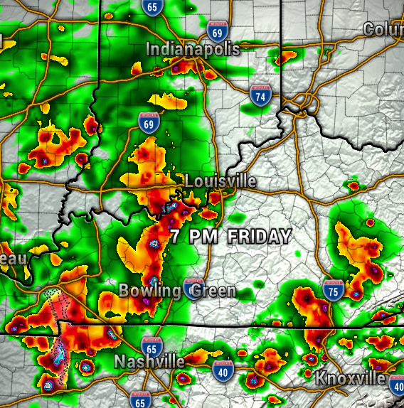
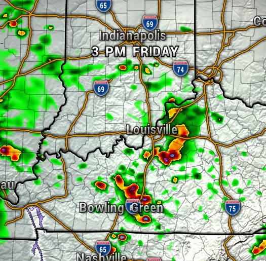
Let’s take a look at when our highest chance of showers and storms will be today and tomorrow (Saturday).
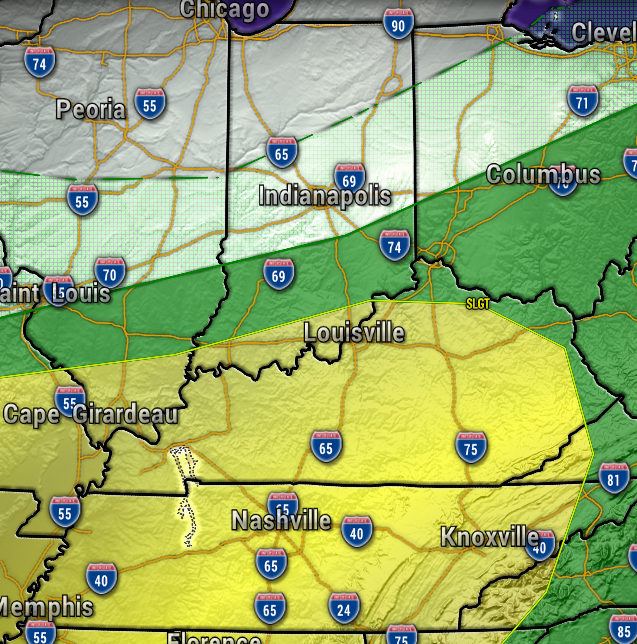
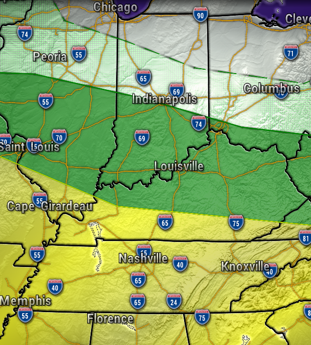
A few pop-up afternoon storms will be possible Friday, before a large cluster of more widespread showers and thunderstorms arrives late day/evening. Give or take, it looks like around 7 PM will be when much of that batch of storms will arrive. The maps below are at 3 PM and 7 PM. So, keep the rain gear handy for your Friday plans!

The overall severe weather threat will be low, but a few storms could become severe with isolated damaging wind gusts. The Storm Prediction Center has much of our area under a Slight Risk (Level 2 out of 5, yellow) of Severe Storms today, with that risk more off to the south Saturday.
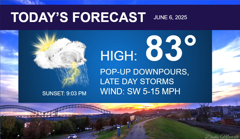
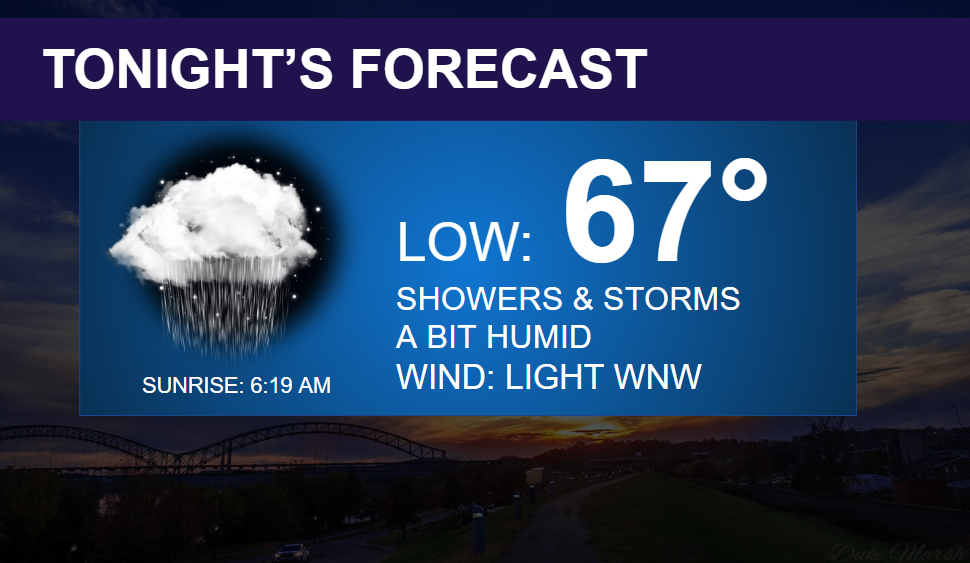
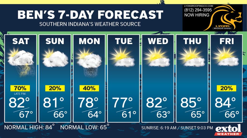
Other than the chance of storms today, it will stay muggy, with highs in the 80s, and the same for Saturday.

The slow-moving front will move south early Sunday and most of the day will be dry. Monday brings more scattered showers, before a drier period of weather is expected for much of next week.
Have a happy Friday and a great weekend! – Meteorologist Ben Peine

