A strong cold front will be moving through Southern Indiana and Kentucky late Saturday night into Sunday morning with heavy rain, lightning, and gusty winds. The overall severe weather threat is low, however there is small chance of damaging wind gusts. Let’s look at the timing first, then the wind threat.
TIMING:
The line of storms is expected to stay west through the day Saturday. Before the rain arrives it will be rather warm and breezy, with near record highs in the 80s across the region.
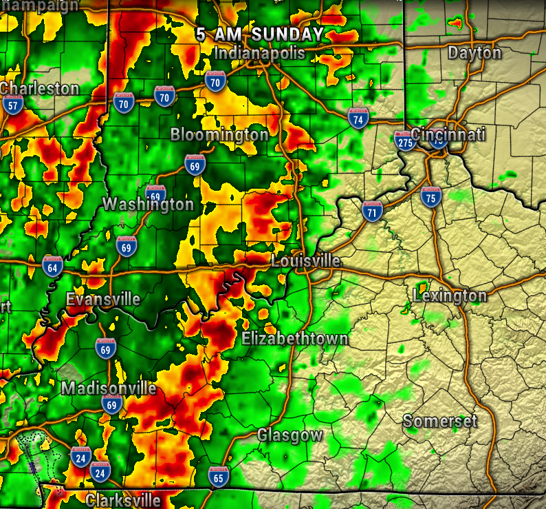
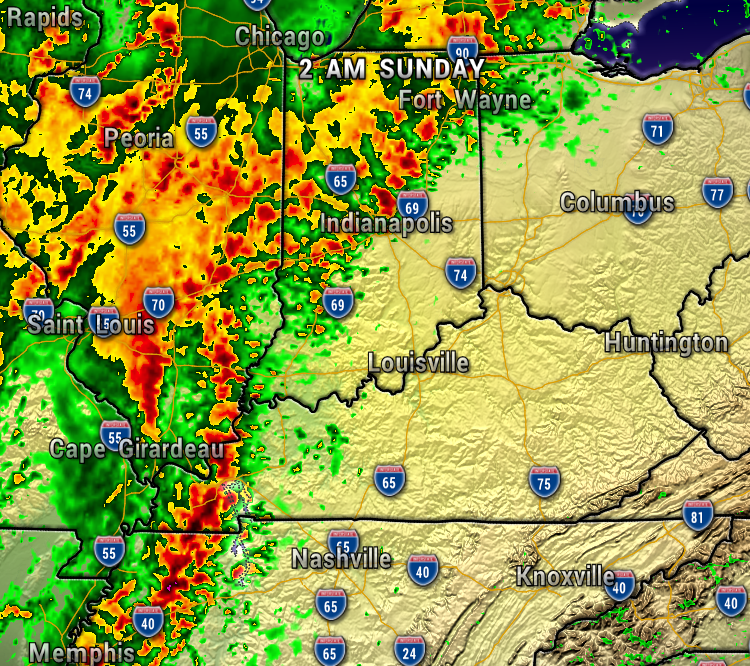
Most of the weather model data have the showers and storms arriving after midnight. After the overnight storms roll through, we’ll have lingering scattered showers and windy conditions through much of Sunday.
The first map is at 2 AM Sunday, the next at 5 AM Sunday.

The next maps are late morning and then late afternoon/evening Sunday. Most of the models have the rain tapering off in the afternoon.
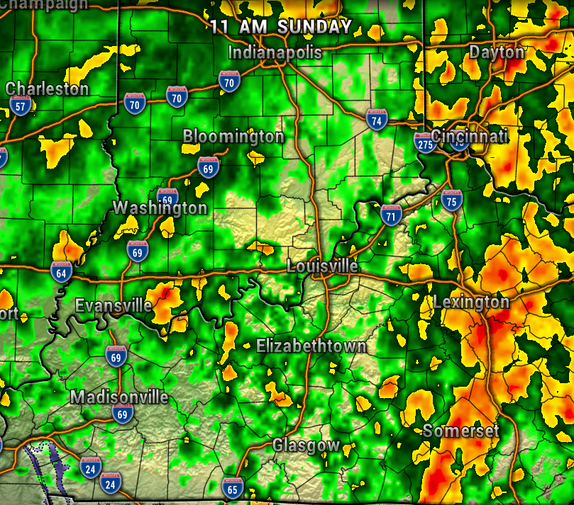
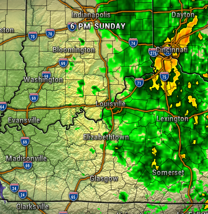
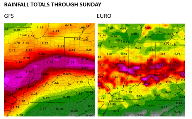
Rainfall totals will likely be around an inch or less, so no significant flooding is expected.
STRONG WINDS:
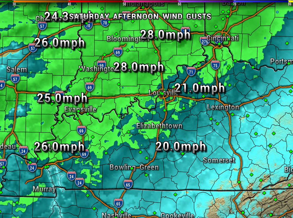
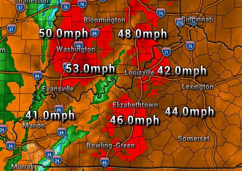
The high winds will be an impact though. Wind gusts will be around 20-25 mph Saturday, then increasing to possible over 40 mph through the overnight and into Sunday morning.
The first map shows Saturday afternoon wind gusts, the next is overnight in the early Sunday morning as the storms move through our area. Put away anything you don’t want to blow away, especially those Halloween decorations!
SEVERE WEATHER RISK:
The Storm Prediction Center has our area under what’s called Marginal Risk of severe storms, or level 1 out of 5. So, again, the risk of severe weather is fairly low for us, and higher off to our southwest.
The Storm Prediction Center has our area under a 2% risk of a spin-up tornado. Which means if you draw a 25-mile circle around your house, there’s only a 2% risk – which is very small.
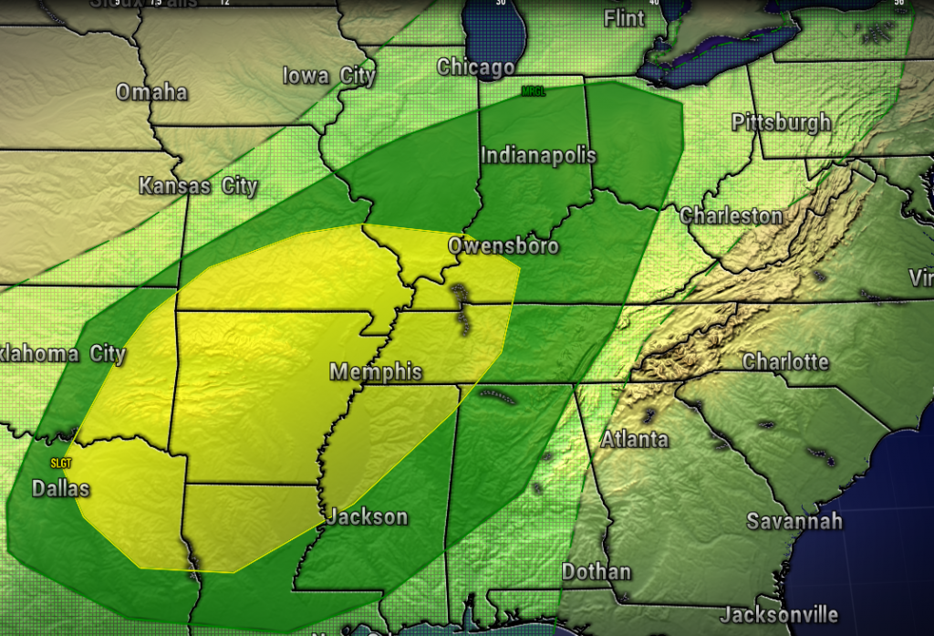
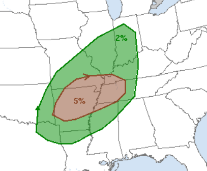
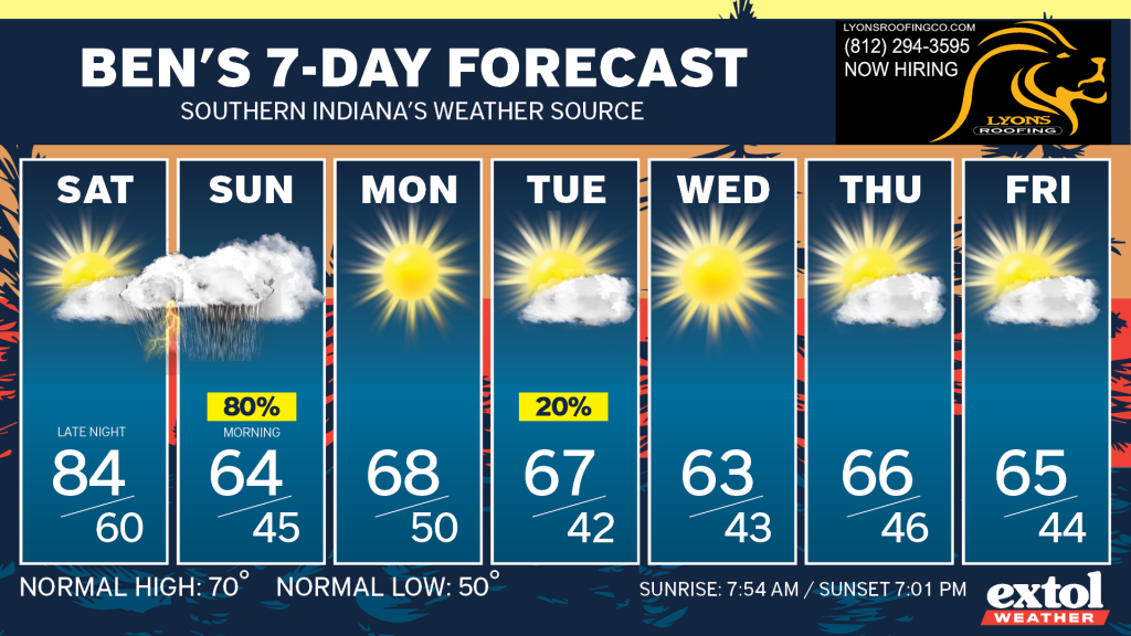
To sum up the weekend, Saturday will be your pick outdoor day, then plan on indoor activities Sunday.
There will be a 20-degree temperature drop from Saturday to Sunday. Sunday’s weather will be blustery and showery, with 30-40 mph wind gusts leftover behind the cold front. Winds will begin to die down Sunday night. A good day to throw something in the crockpot, maybe some soup or chili!
A cooler pattern settles in for next week.
Meteorologist Ben Peine


