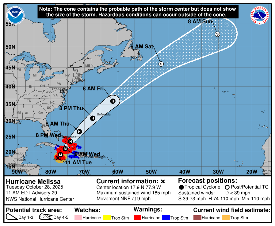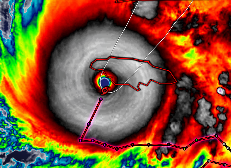
Hurricane Melissa made landfall along the southwest coast of Jamaica Tuesday morning as one of the strongest hurricanes ever in the Atlantic Ocean. The monster storm is packing maximum sustained winds at 185 mph, gusts over 200 mph.
Melissa is the third (tie) most intense hurricane on record in the Atlantic, with a pressure of 892 millibars (normal air pressure 1013 millibars). Lower the pressure, the stronger the storm.

The storm is crossing Jamaica today (Tuesday), then heading toward eastern Cuba, then the Bahamas.
KEY MESSAGES:
1. Jamaica: THIS IS AN EXTREMELY DANGEROUS AND LIFE-THREATENING
SITUATION! TAKE COVER NOW! Catastrophic winds with total
structural failure are likely near the path of Melissa’s center.
Catastrophic flash flooding, landslides, and destructive winds are
expected across the remainder of the island causing widespread
infrastructure damage, power and communication outages, and isolated
communities. Along the southern coast, life-threatening storm surge
and damaging waves are expected through the day.
2. Haiti and the Dominican Republic: Catastrophic flash flooding
and landslides are expected across southwestern Haiti and southern
portions of the Dominican Republic through midweek. In Haiti,
extensive damage and isolation of communities is likely. Tropical
storm conditions are expected later today and Wednesday.
3. Eastern Cuba: Heavy rainfall, flash flooding and landslides are
expected soon. Life-threatening storm surge and damaging winds are
likely to begin later today. Complete all preparations now.
4. Southeastern and Central Bahamas and the Turks and Caicos:
Hurricane conditions, life-threatening storm surge, and heavy
rainfall are expected across portions of the southeastern and
central Bahamas on Wednesday. Complete preparations by tonight and
follow local official guidance. Tropical storm conditions, heavy
rains, and significant storm surge are expected in the Turks and
Caicos Islands on Wednesday.
