Our weather pattern has been rather dry for a long time, and will continue to be, and this will lead to the likelihood of Rapid Onset Drought or “Flash Drought” conditions for Southern Indiana and Kentucky.
The Climate Prediction Center’s 8-14 Day U.S. Hazards Outlook has our region under Flash Drought potential, and you can also see the abnormally dry soil forecast as well for our region below.
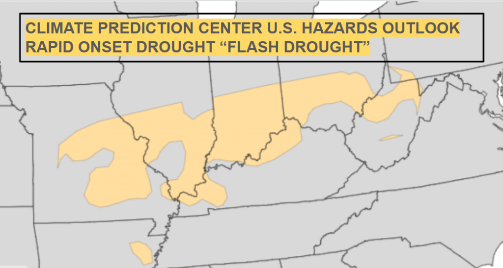
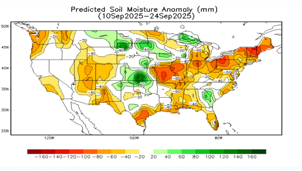
So what is a Flash Drought? It is a drought that occurs in a matter of day or weeks, more quickly than gradually worsening drought conditions.
How Flash Droughts Form:
- Low Precipitation: A lack of rainfall creates a deficit in the soil’s water supply.
- High Evaporative Demand: This is driven by anomalously high temperatures (a heatwave), strong winds, sunny skies, and low humidity, all of which increase the rate at which water evaporates from the soil and plants (evapotranspiration).
- Rapid Drying: The combined effect of low moisture and high demand quickly removes available water from the land, leading to a rapid decline in soil moisture and plant stress.
Key Characteristics:
- Speed: The defining feature is the speed at which drying conditions develop, often over a period of weeks rather than months or seasons.
- Atmospheric Drivers: Unlike traditional droughts, which are primarily driven by precipitation deficits, flash droughts are strongly influenced by atmospheric conditions that increase evaporation.
- Compound Events: They can be seen as a result of compound events, where a period of dryness is accompanied by weather extremes.
Impacts:
- Agriculture: Flash droughts can quickly cause significant agricultural losses and crop damage.
- Fire Risk: They contribute to increased risk of wildfires.
- Water Resources: They pose challenges for water management and ecosystems.
So, what’s causing this weather pattern? Well, we have a stuck area of high pressure as the surface and aloft we have an upper-level ridge building into the Ohio Valley. High pressure is sinking air, which doesn’t allow storm systems to develop. Just a stuck dry pattern. Notice on the 8-day rainfall total from the European Weather Model, there is just a hole of dry weather over our region and the Deep South.
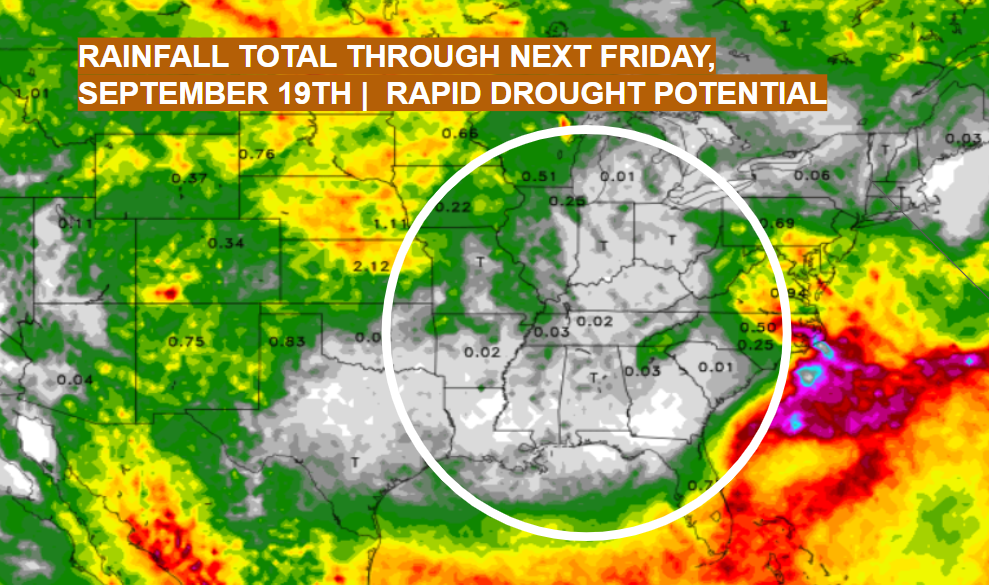
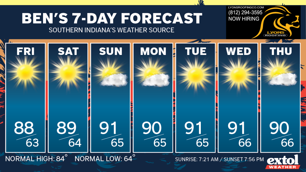
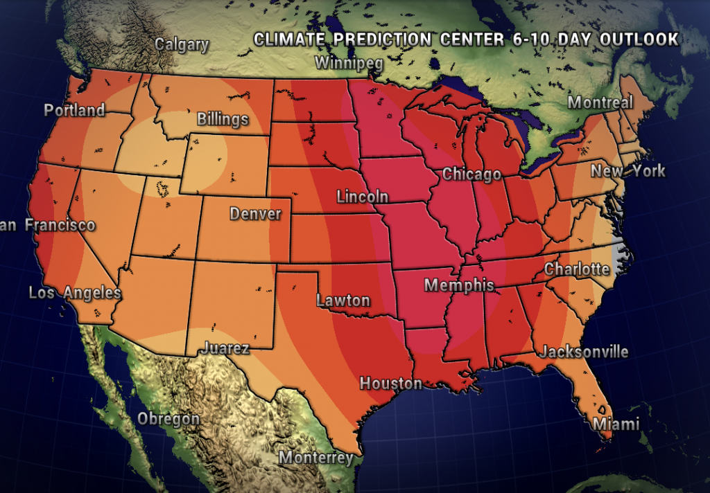
With the dry weather, it’s also going to be a bit hot through next week with temperatures trending 5-10 degrees above normal in the upper 80s and low 90s. A dry heat. This will also contribute to quick evaporation and worsening drought potential.
Below is the 6-10 Day Temperature Outlook from the Climate Prediction Center, which shows high confidence in an above normal temperature pattern through next week, and through possibly the rest of our summer season.
With this very dry pattern, be careful with any outdoor burning and keep an eye on your local county burn bans. Links to Indiana and Kentucky burn bans are below.
